Project: 1.3.5
Managing fire to recover monsoon vine thickets on the Dampier Peninsula
Project Leaders: Sarah Legge , Brett Murphy , Louise Beames , Malcolm Lindsay
Research in Brief
The monsoon vine thickets on the Dampier Peninsula are a threatened ecological community that are of high cultural significance to the Indigenous people on the peninsula. The thickets are vulnerable to intense late dry season fires, weed incursion, and damage from feral herbivores. Recovery actions by ranger groups, pastoralists and other land managers have included using prescribed burning across the Dampier Peninsula to reduce the extent and frequency of high intensity fires around the vine thickets. This project aims to use remote sensing to detect changes in canopy health and fire patterns over the past 30 years, to measure the effectiveness of these recovery efforts.
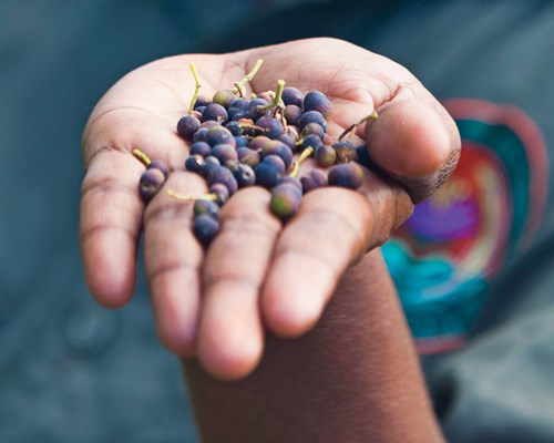
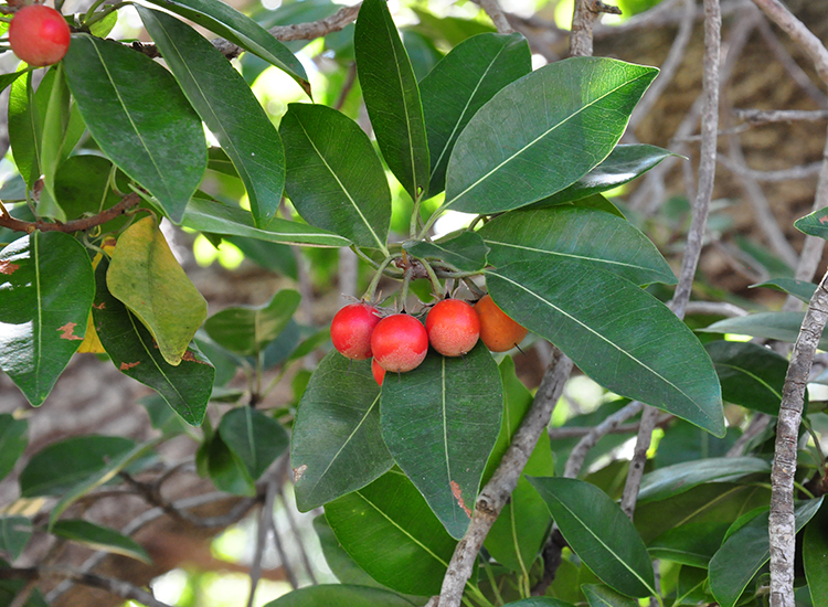
Nyul Nyul Ranger displays the fruit of Goolm, Grewia breviflora. Photo: Damian Kelly
Why is the research needed?
In 2013, the monsoon vine thickets on the Dampier Peninsula were listed as a Threatened Ecological Community under the EPBC Act. The vine thickets of the peninsula are the southernmost examples of this vegetation type in tropical Australia and are distributed in over 70 patches around the coast. They are of high cultural and ecological significance to the Indigenous people in this region, containing highly favoured bush foods, medicinal sources, other resources and cultural sites. Almost all the monsoon vine thicket patches are on land managed by Indigenous groups (Bardi Jawi, Nyul Nyul, Yawuru, Jabirr Jabirr, Bindunbur). Various programs haven been in place for several years to protect and restore this community, in the last few years under the Monsoon Vine Thicket Working Group, which is transitioning to become the National Recovery Team.
The monsoon vine thickets are threatened by late dry season fires: frequent and extensive fires occurring in neighbouring pindan woodland have threatened this community for over 30 years. These fires affect the vine thicket boundaries, causing damage to the vine thicket canopy and reducing the size of patches over time.
Since 2015, the ranger groups, pastoralists and other land managers of the Dampier Peninsula have collaborated through the Dampier Peninsula Fire Working Group to manage fire in a cross-boundary approach over the peninsula.
Both the Dampier Peninsula Working Fire Group and Monsoon Vine Thicket Working Group requested this research, in order to gain an understanding of how their fire management is affecting the recovery of the monsoon vine thicket communities.
This project aims to provide land managers with information about whether their recent efforts to reduce the incidence of damaging fire around the vine thickets are helping to recover this threatened ecological community.
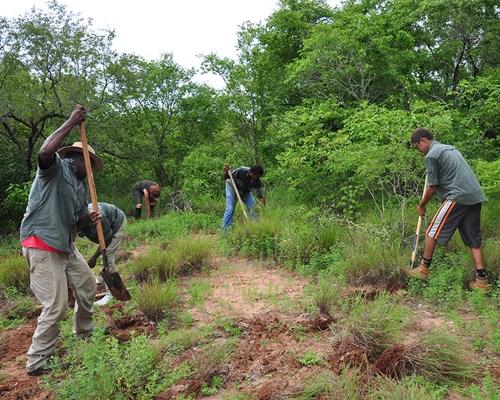
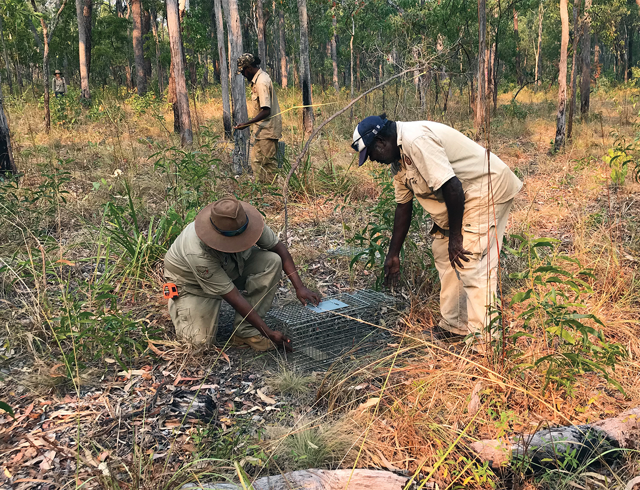
Nyul Nyul Rangers removing buffel grass from the edge of degraded monsoon vine thicket. Photo: Louise Beames
How can the research help?
The data will feed directly into recovery planning, management and reporting, and protection and management of a nationally threatened ecological community.
The research will document the changes in fire regimes, and changes to the extent and canopy structure of the monsoon vine thickets, that have taken place over the past 30 years. We are particularly interested in changes that reflect the more recent management efforts to recover this threatened vegetation community.
Monsoon vine thickets and some of their constituent species are key targets in the relevant Healthy Country Plans of Indigenous land managers, as well as the Monsoon Vine Thicket Conservation Action Plan and the Fire Management Plan of the Dampier Peninsula Fire Working Group. The development of remote sensing methods will provide Indigenous ranger groups with an approach to monitoring, and reporting on, progress towards meeting their Healthy Country targets. The remote sensing monitoring can also help to identify those monsoon vine thicket patches in greatest need of management intervention.
Finally, the results from the analysis can be used to inform sampling design for on-ground monitoring of vegetation and fauna and cultural values, such as across vine thicket patches that have experienced contrasting degrees of fire threat and damage.
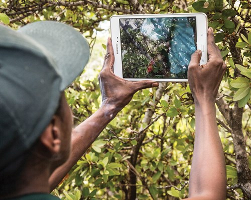
Ranger collecting information about fruit and seed in a monsoon vine thicket during seed collection training. Photo: Damian Kelly
What research activities are being undertaken?
The research will largely be undertaken using remote sensing platforms and mapping software to interrogate imagery captured by the ‘Landsat’ family of satellites over recent decades. This satellite imagery will be used to detect changes in canopy health, and changes in the fire regime. Measuring canopy health will involve using a vegetation index to observe yearly changes to the canopy condition of each patch. We will measure the extent and frequency of fires occurring within 300 metres of each patch, and collect data in a timeline spanning approximately 30 years to demonstrate changes within the landscape both with and without active fire management in the region.
The aim of the project has been developed collaboratively by Indigenous ranger groups, pastoralists and involved agencies. Once we have developed the methods, we will host a training workshop for ranger groups and other members of the Fire and Monsoon Vine Thicket Working Group to transfer the techniques, so that the monitoring approach can be continued, and included in reporting against the Healthy Country Plans, and reporting against the Fire Management Plan of the Dampier Peninsula Fire Working Group.
Who is involved?
Indigenous ranger groups (Bardi Jawi, Nyul Nyul and Yawuru), other Traditional Owner groups, pastoralists and various agencies, facilitated by Rangelands NRM, make up the Dampier Peninsula Working Fire Group (DPWFG). The same ranger groups, with WA DBCA and Environs Kimberley, are also in the Monsoon Vine Thicket Working Group (MVTWG).The University of Queensland, Charles Darwin University and Environs Kimberley are research partners.
The DPFWG and the MVTWG are supported by funding from the Western Australian Government’s State NRM program, and the National Landcare Program.
Where is the research happening?
The research will be conducted in the Dampier Peninsula, which is located north of Broome in Western Australia. The Dampier Peninsula also forms part of the West Kimberley.
When is the research happening?
The project will run during 2020 until mid 2021.
Further information
For more information please contact:
Anna Lemon - anna.lemon@students.cdu.edu.au
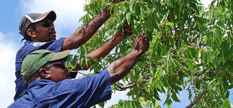
Top image: Bardi Jawi Rangers collecting Goolmi, Grewia breviflora, a valued monsoon vine thicket species. Photo: Louise Beames