Project: 4.4.8
Mapping distributions, threats and opportunities to conserve the greater glider
Project Leaders: Natalie Briscoe , Casey Visintin
Research in Brief
This project will inform landscape management actions and recovery planning for the greater glider across its whole range by mapping threats and opportunities for management, and improving predictions of species’ persistence and range changes.
The research team will use a powerful new modelling framework to assess the combination of effects of wildfire, logging and habitat fragmentation along with a strong focus on climate change on greater glider populations, and explore the effectiveness of management strategies such as prescribed burning programs and area protection across regions.
Using greater gliders as a case study, we will map persistence of threatened species under changing environments to better inform conservation decisions. This project complements other work by the TSRH.
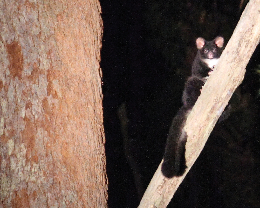 A greater glider in the spotlight. Photo: Toby Hudson CC BY-SA 3.0 Wikimedia Commons
Why is the research needed?
Greater gliders are a large arboreal possum that relies on large hollow-bearing trees in forests along the east coast of Australia. This species was recently listed as Vulnerable nationally and in Victoria based on population declines and habitat loss, and it faces the cumulative impacts of a range of threats including habitat loss, fire and climate change. To halt the decline of this species we must account for how these threats interact with one another to influence the long-term persistence of greater gliders in the landscape.
A long-term management plan that protects key glider populations and ensures important glider habitat is maintained into the future will be critical for conserving this species because gliders have slow life history characteristics (which limits their ability to recover from declines), poor dispersal, specialist requirements for large tree hollows (and therefore mature forests), and are likely to be vulnerable to climate change impacts, including increased frequency of fires. 
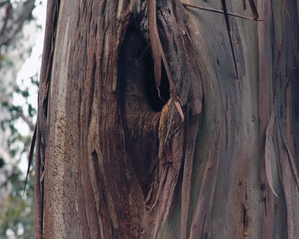
This stag tree can provide hollows for the greater glider and other species. Photo: David Blair
How will the research help?
This project will integrate state-of-the-art distribution and population modelling approaches to model the population viability of greater gliders across their range. This powerful new framework will allow us to assess the combination of effects of wildfire, logging, habitat fragmentation and climate change on greater glider populations, as well as to explore the effect of management strategies such as prescribed burning programs, area protection and reintroductions/translocations.
The models we develop here will provide more accurate forecasts of whether species are declining, and take into account climate change and changes in habitat across the landscape when developing actions to address other key threatening processes. This is particularly important for species such as the greater glider, where climate change is likely to interact with other threats, and could strongly alter the effectiveness of proposed management actions and decisions about allocation of management resources. ![]()
![]()
Even when retained within logging coupes, the large old trees that greater gliders depend on can be killed by regeneration burning following logging operations. Photo: David Blair
What research activities are being undertaken?
The research team will link biophysical models with models of landscape dynamics and population dynamics models for the greater glider. We will then use this modelling framework to simulate historic and future greater glider population dynamics different landscapes.
The outputs of this modelling approach will be compared with those of simpler modelling approaches currently used more widely in distribution mapping and range change modelling. This will give insight into the relative importance of key drivers of decline (and how these interact), as well as providing spatial predictions of key habitat. We will work with management agencies and the recovery team (once established) to identify appropriate management actions, and run simulations to assess their likely effectiveness in different regions.
Population modelling and spatial mapping of key habitat and threats are included in the scope, along with assessments of the cost-effectiveness of different management actions. The collection of new ecological data, long-term monitoring or implementing on-ground management actions are not within the scope of this project.
Who is involved?
The project is being led by the University of Melbourne who are working with researchers from The Australian National University, Charles Darwin University, and James Cook University, along with the Victorian Department of Environment Water Land and Planning’s Arthur Rylah Institute, Parks Victoria, the Commonwealth Department of Environment and Energy’s Protected Species Branch, the Queensland Department of Environment and Science and the NESP Earth Systems and Climate Change Hub. 
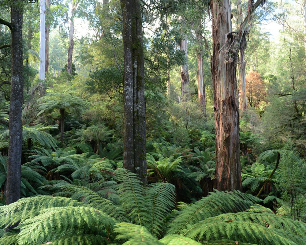
Old growth forest in the O’Shannassy catchment is greater glider habitat. Photo: David Blair
Where is the research happening?
Modelling will be conducted for greater glider populations across eastern Australia.
When is the research happening?
The project will run from 2018 to June 2021.
Further Information
For more information please contact:
Casey Visintin - casey.visintin@unimelb.edu.au
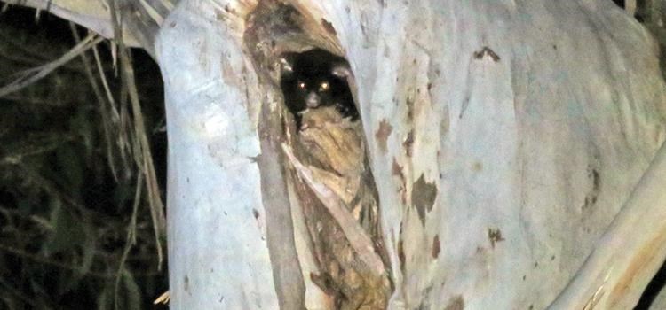
Top image: Greater glider in tree hollow. Photo: Donald Hobern Flickr_CC by 2.0